🚁 AERIAL PHOTOGRAPHY & VIDEOGRAPHY
Elevate Your Listings with Stunning Drone Views
Capture breathtaking aerial perspectives that showcase properties, land, and ranches like never before. Our professional drone services deliver stunning photography, immersive video tours, and 360° virtual experiences that attract more buyers and close sales faster.
🚁
Breathtaking Footage
Capture panoramic views, sweeping landscapes, and intricate details from unique aerial perspectives.
📍
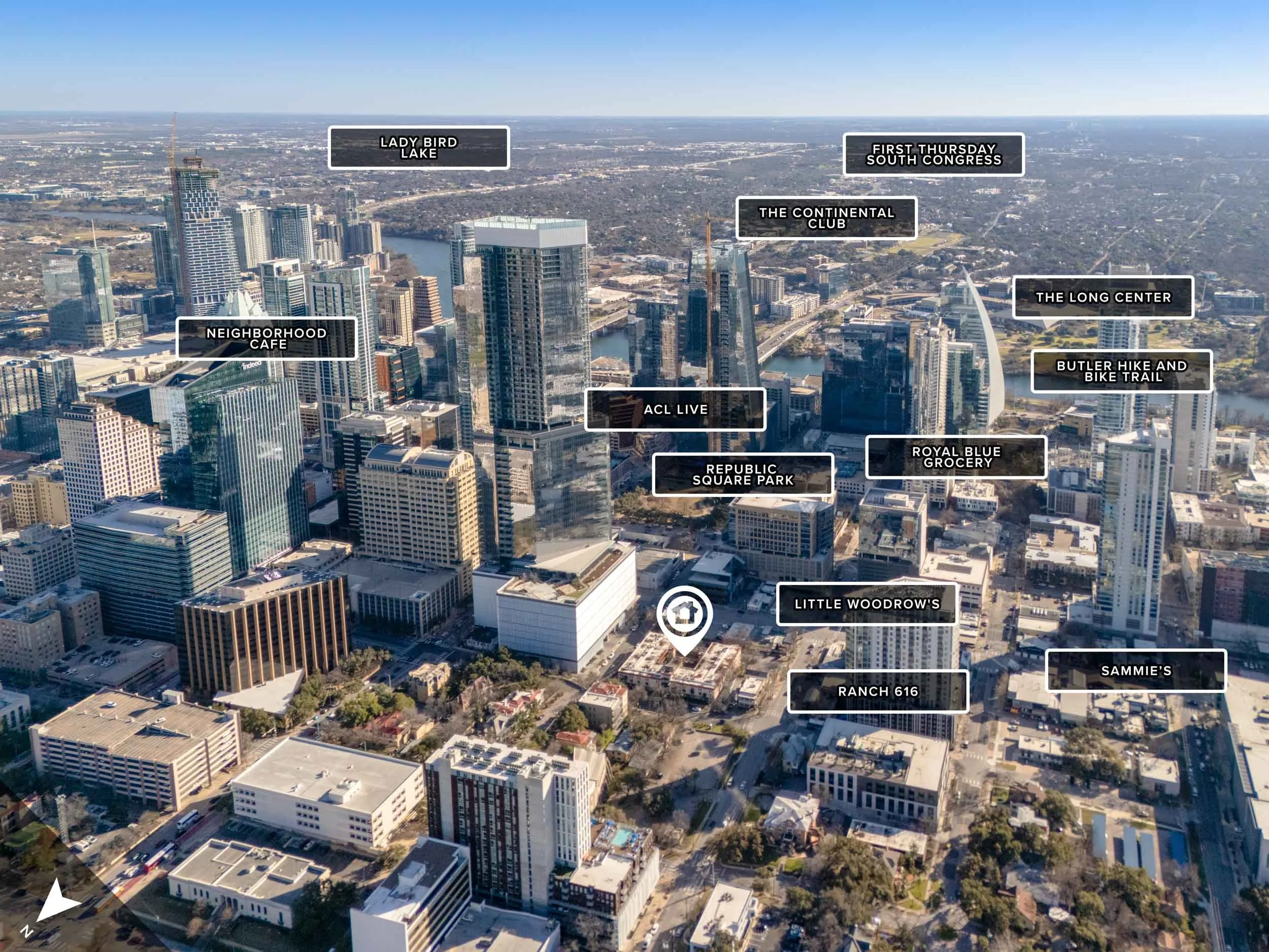
Property Mapping
Clearly marked property lines, sun orientation, and landmark highlighting for complete context.
🎥
Professional Video Tours
Custom branded videos optimized for social media with dynamic speed-ramping and cinematic transitions.
🌐
360° Virtual Tours
Immersive aerial experiences that let buyers explore properties from every angle, anytime, anywhere.
AERIAL PHOTOGRAPHY
Stunning Views from Above
Boost your real estate listings with professional drone photography! Capture stunning aerial views that highlight property features, showcase location context, and make your listings stand out. Attract more buyers with eye-catching images that showcase homes like never before.
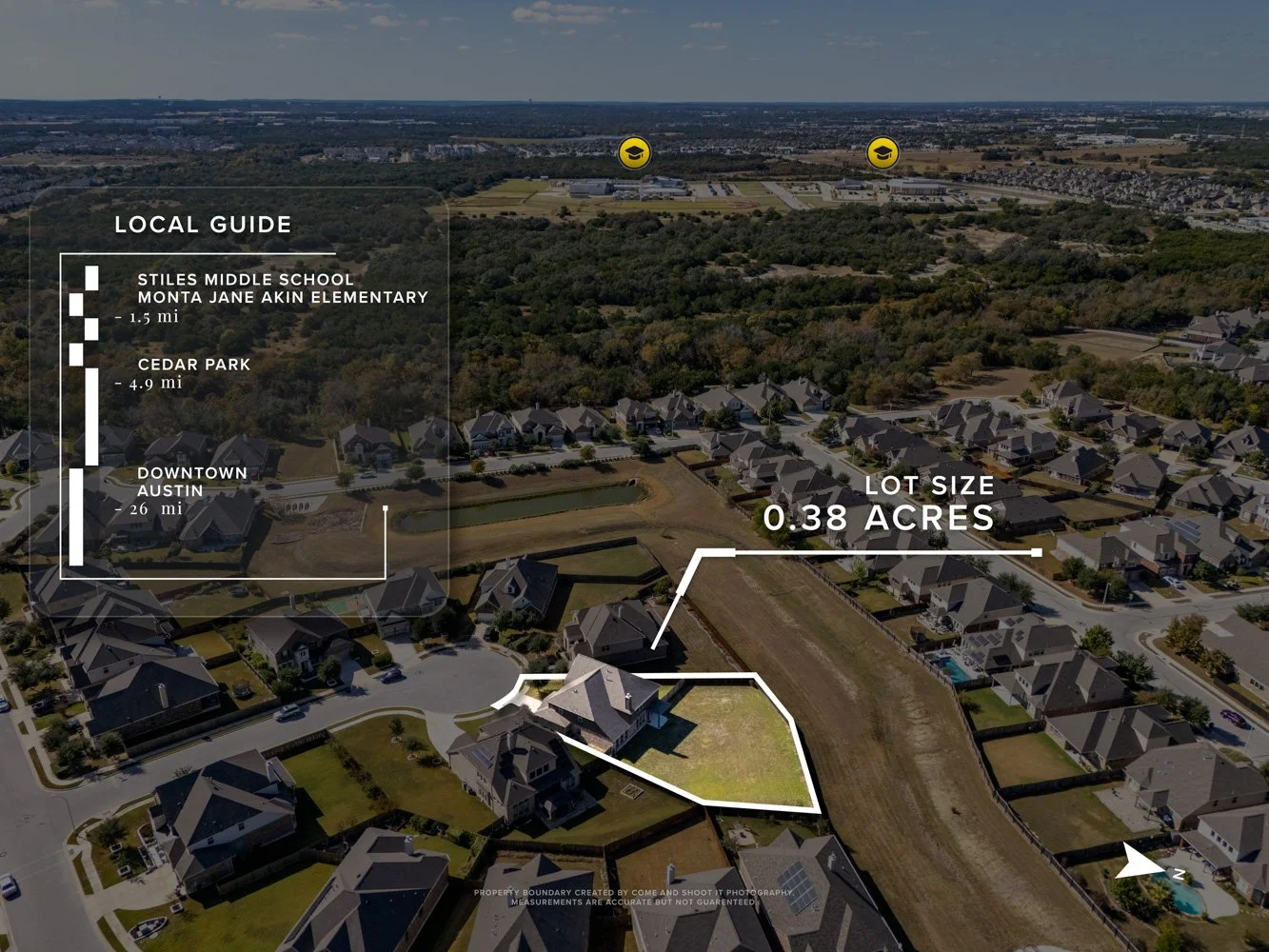
→ Property lines marked on images
→ Landmark highlighting with titles
→ Multiple angles and perspectives
→ High-resolution aerial photography
→ Perfect for homes, land, and ranches
DRONE VIDEO TOURS
Captivating Aerial Video
Elevate your real estate marketing with professional drone video tours! Captivate potential buyers with stunning aerial views of properties and neighborhoods, giving them a unique perspective they won't forget. Our drone videography makes your listings stand out, showcasing properties in a way that grabs attention and drives interest.
→ Sweeping cinematic aerial footage
→ Animated property lines in videos
→ Dynamic speed-ramping transitions
→ Social media optimized content
→ Realtor Spotlight intro (optional)
360° AERIAL TOURS
Immersive Virtual Experiences
Take your real estate listings to the next level with 360-degree aerial virtual tours! Let buyers explore properties anytime, anywhere—whether they're on their couch or halfway around the world. Glide through the skies and navigate around the property as if you're soaring with a drone—think Google Maps or Matterport, but way cooler and higher up!
→ Interactive 360° aerial navigation
→ Navigate like Google Maps or Matterport
→ Explore from any device, anywhere
→ Landmark and amenity highlighting
→ Perfect for large properties and land/ranch
LAND & RANCH SPECIALISTS
Showcase Large Properties
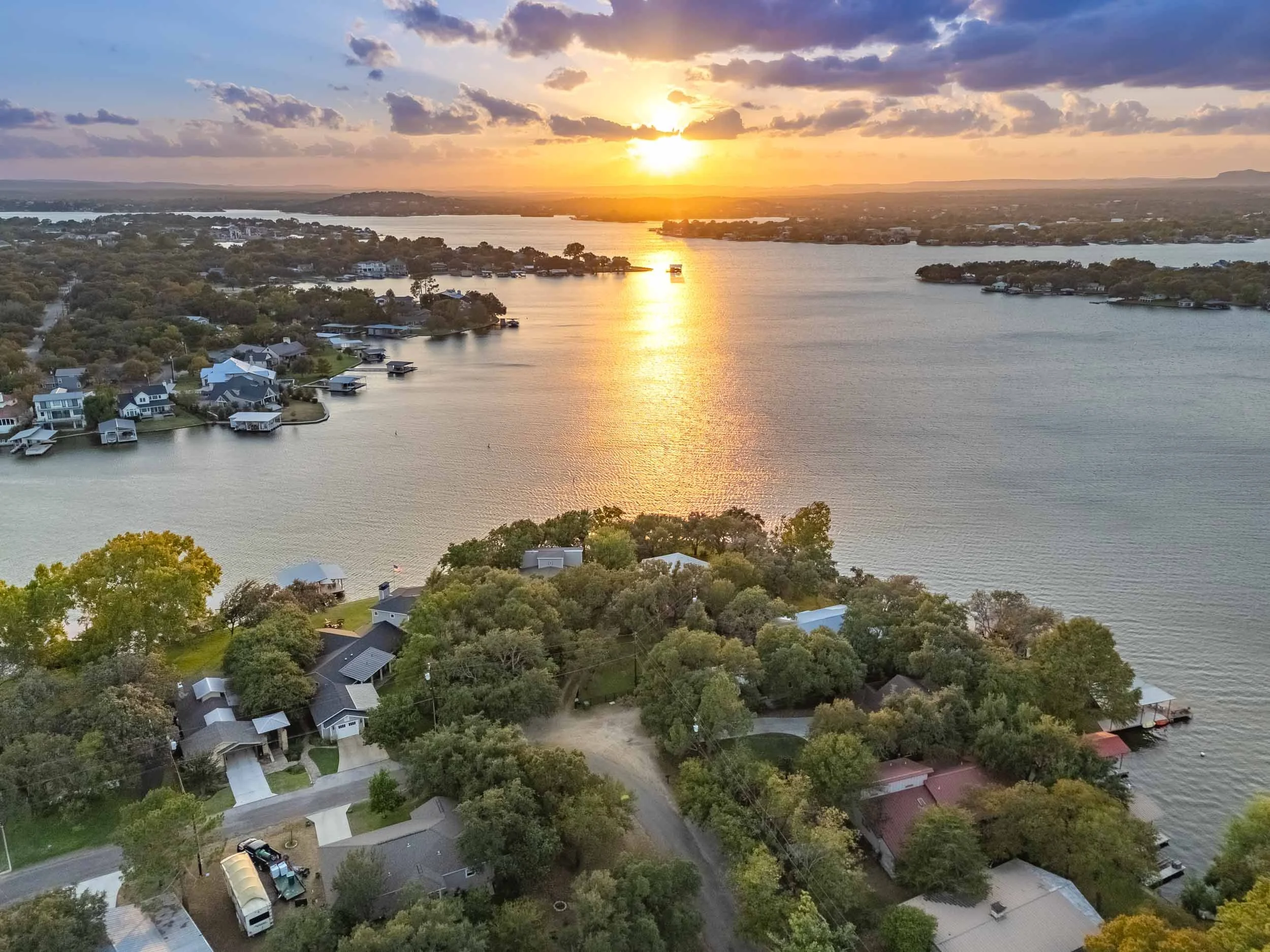
Our SkyView drone service is perfect for large properties, land, and ranches. Capture breathtaking panoramic views that show the full scope and beauty of expansive properties. Help buyers understand location, terrain, natural features, and property boundaries from perspectives impossible to achieve from the ground.
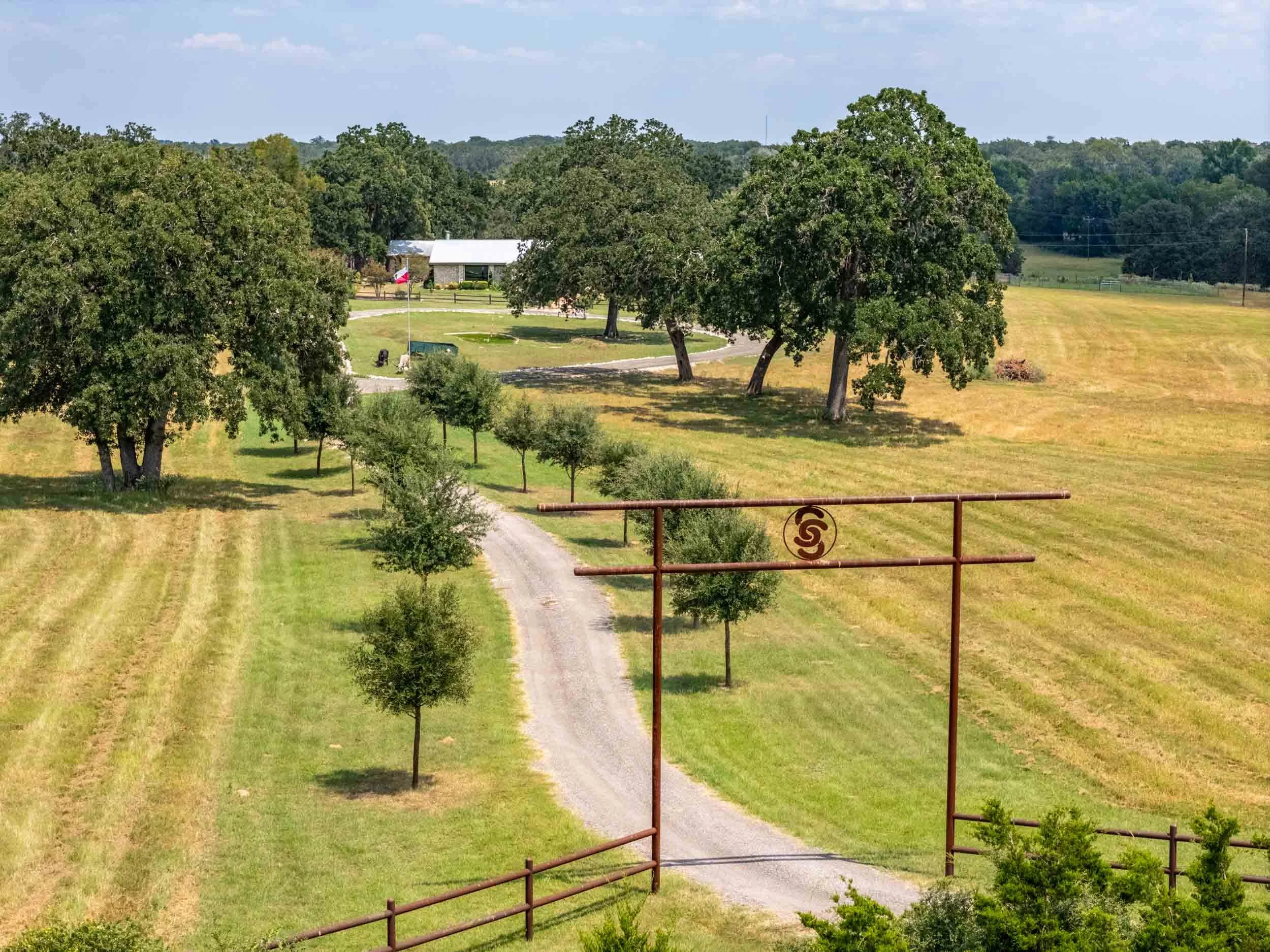
→ Expansive panoramic aerial views
→ Natural features highlighting
→ Property boundary and compass graphics
→ Low flying aerial photography
→ Ideal for acreage and ranch listings
Recent Aerial Work
Browse stunning examples from our drone photography and video portfolio


Simple, Seamless Process
From booking to delivery, we make it effortless
Schedule Flight
Contact us with property details, location, and specific needs. We'll coordinate timing based on weather and lighting conditions.
1
Pre-Flight Planning
We review airspace regulations, plan flight paths, and coordinate shot lists to capture every important angle and feature.
2
Professional Capture
Our certified drone pilots arrive with professional equipment to capture stunning aerial photography and video footage.
3
Fast Delivery
Edited aerial content delivered within 24 - 48 hours via private online gallery, ready to use in your marketing immediately.
4
Aerial Drone Media FAQ
What's included with drone photography?
Our aerial package includes a mix of straight-down (bird's eye) and angled shots that showcase the property, lot, and neighborhood context. Most shoots deliver 5-10 aerial images depending on the property's features and acreage.
What properties benefit most from drone photography?
Aerial photos have the biggest impact on properties with acreage, pools, waterfront or golf course views, unique rooflines, or desirable neighborhood amenities like parks and trails. For a standard suburban lot without standout features, ground-level exteriors often tell the story just as effectively.
Can drones fly anywhere?
Not always. Some areas fall within restricted airspace—near airports, military installations, or other controlled zones. We verify airspace restrictions before every shoot. If your property is in a no-fly zone, we'll let you know upfront and discuss alternatives.
What if it's too windy or rainy for drone photography?
We monitor weather conditions closely. If winds exceed safe operating limits or rain is expected, we'll reschedule the aerial portion at no charge. Interior photography and ground-level exteriors can still proceed as planned.
How much does drone photography cost?
Aerial photography starts at $75 as an add-on to any photography package. View our Pricing Guide for complete details.
What is a 360° Aerial Tour?
Think of it as a 3D virtual tour (like Matterport), but from the sky. We capture a high-resolution 360° panorama from above, letting buyers rotate the view and explore the entire neighborhood. These aerial panoramas can link directly to your interior 3D tour, creating a seamless ground-to-sky experience.
Can you add labels or annotations to aerial photos?
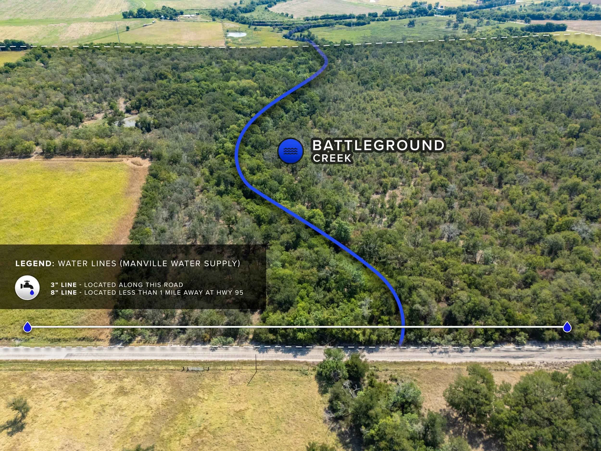
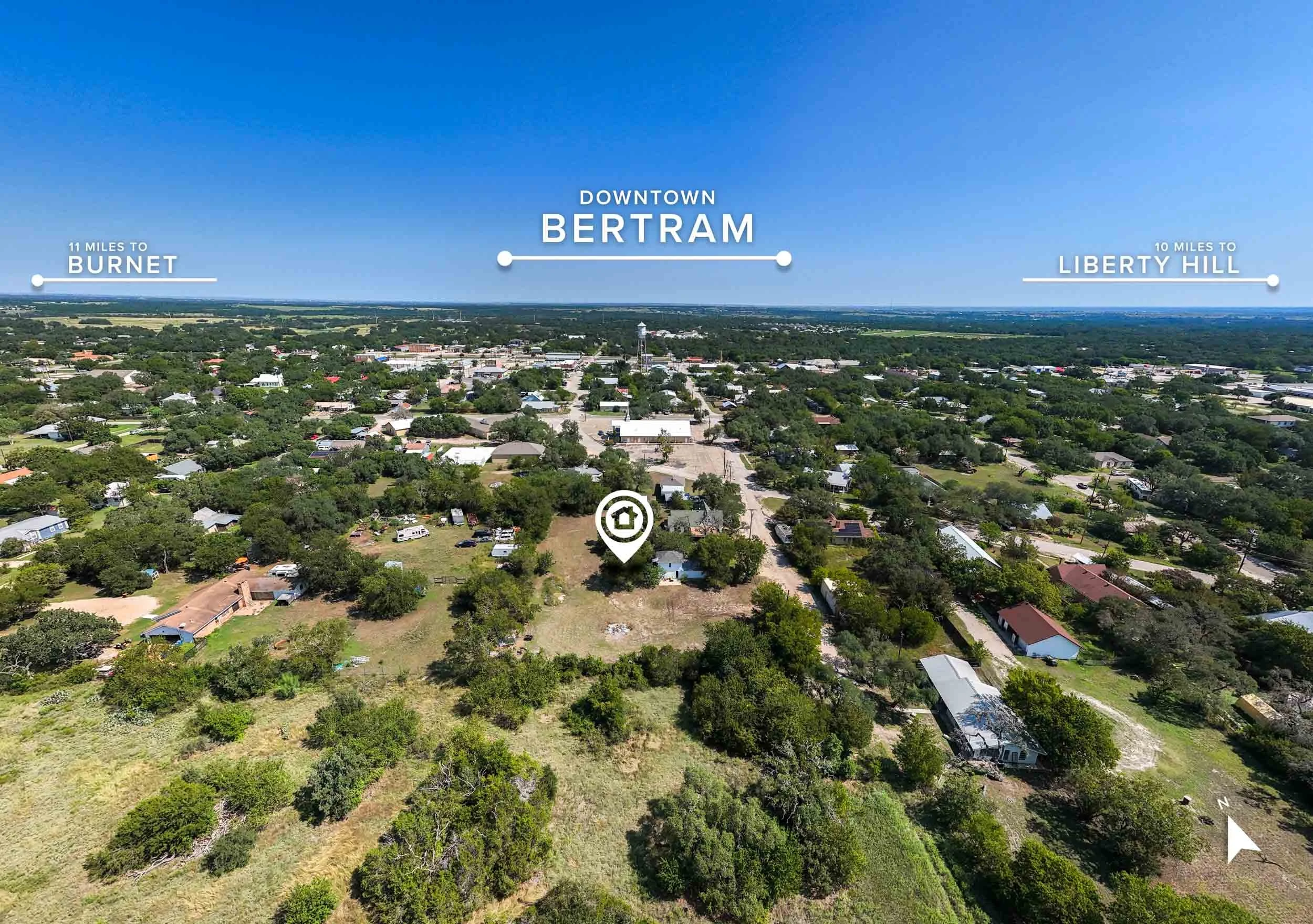
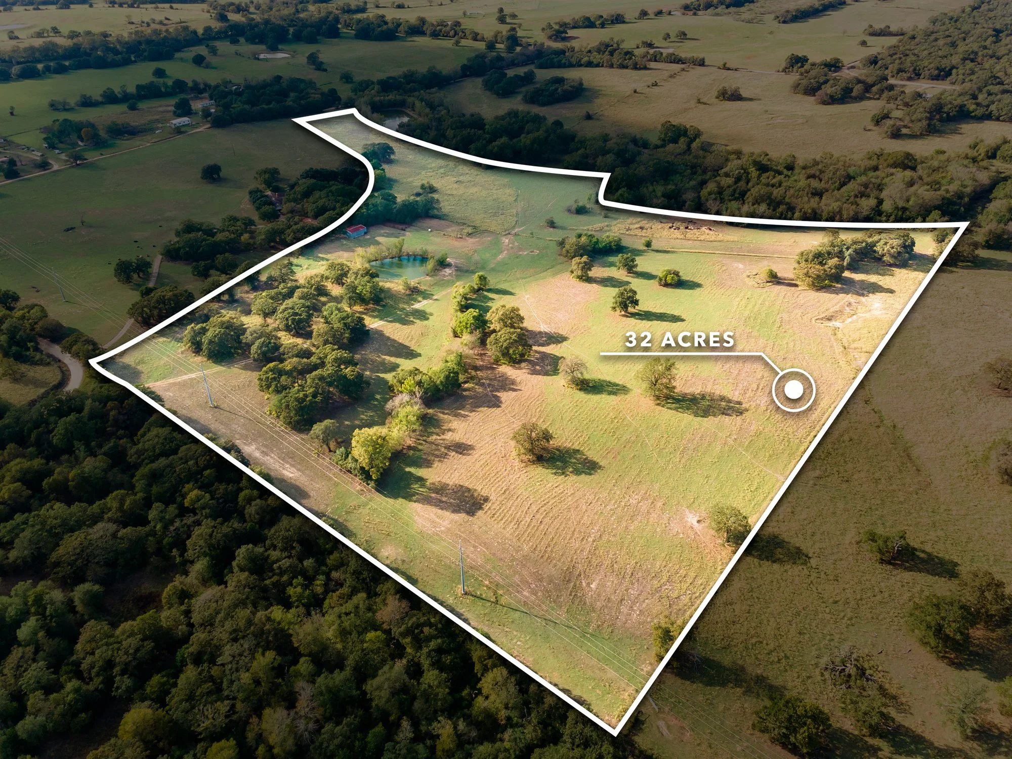
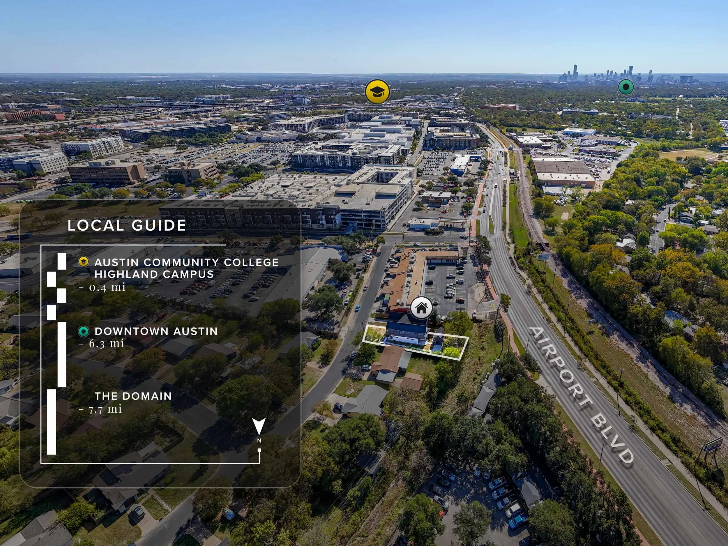
Yes. For land, ranch, and acreage listings, we can overlay helpful information graphics directly on your aerial images—things like property boundaries, utility locations, water sources, road frontage, and distances to nearby amenities. This gives buyers a clear understanding of what they're looking at without having to guess.
Why choose interactive aerials over standard drone photos?
Standard drone photos are static snapshots. Interactive 360° tours and annotated aerials provide information buyers can see exactly where lot lines fall, locate the nearest utilities, and understand what surrounds the property, all in one interface. They also keep buyers engaged with your listing longer, which signals value to platforms like Zillow and can improve your listing's visibility. For land and acreage, this context and engagement often matters more than the photos themselves.
What types of properties benefit from advanced aerial services?
360° aerial tours and site analysis graphics are ideal for ranch land, undeveloped lots, large acreage, new construction sites, and commercial properties. For standard residential listings, our regular drone package typically provides everything you need.
Ready to Showcase Your Listing?
Book your real estate photography session today and give your listings the professional edge they deserve.
Proudly Serving Central Texas
Based in Cedar Park, we provide professional real estate photography throughout the Austin metro area and beyond.
Austin
Westlake
Pflugerville
Georgetown
Taylor
Leander
Marble Falls
Round Rock
Liberty Hill
Lakeway
Bee Cave
And More